Hi everyone.
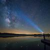
I have a project that I have been working on for the past 2 months. My goal was to make the best website for light pollution maps.
DarkSiteFinder.com
I use light pollution data that has been around for awhile but most of it has never been combined with Google Maps before. All the maps on this site are full screen, searchable, and the overlay can be toggled on and off. There is a 15 color light pollution map of the United States from Dave Lorenz that some may find more useful than the 8 color.
Besides the US, light pollution data is now easily viewable for almost any place in the world. The data from the Light Pollution Science and Technology Institute has been available for years but I'm not aware of any other websites that made it all easily viewable.
Also on the site I included some links and information about how to reduce light pollution. I'm planning to have a section that will have an extensive list of observing sites. But that will remain under construction for awhile longer as I try to find a way to integrate some useful features.
Please let me know how you like the website and if you have any suggestions to make it better.
Introducing DarkSiteFinder.com
Started by
krp
, Jul 21 2013 05:14 PM
52 replies to this topic
#1

krp
-

-
-
 topic starter
- Posts: 461
- Joined: 10 Nov 2010
Vendor. DarkSiteFinder.com
Posted 21 July 2013 - 05:14 PM
#2
beatlejuice
-

-
- Posts: 2,804
- Joined: 05 Apr 2011
Mercury-Atlas
Posted 21 July 2013 - 09:44 PM
I like it. Nice job Kevin! Not quite sure what to make of the variance in colour from the google overlay as 3 of the 4 sites I might normally visit show as darker in your version. Talking about Ontario,Canada about 300 miles north of Toronto, 150 miles East of Toronto and the north shore of lake Erie.
Eric
Eric
#3
krp
-
-
-
topic starter
- Posts: 461
- Joined: 10 Nov 2010
Vendor. DarkSiteFinder.com
Posted 22 July 2013 - 01:06 AM
Glad you like it. If you are looking at the 2001 map that one subtracts the effects of snow cover. Snow reflects light and shows as an increase in light pollution on the 1996/1997 map.I like it. Nice job Kevin! Not quite sure what to make of the variance in colour from the google overlay as 3 of the 4 sites I might normally visit show as darker in your version. Talking about Ontario,Canada about 300 miles north of Toronto, 150 miles East of Toronto and the north shore of lake Erie.
Eric
#4
stevecourtright
-
-

- Posts: 105
- Joined: 12 Nov 2009
Vostok 1
Posted 22 July 2013 - 01:13 PM
Thanks, Kevin. Look forward to lots of sites populating your page(s).
#5
Illinois
-
-
- Posts: 3,677
- Joined: 18 Dec 2006
Soyuz
Posted 27 July 2013 - 07:12 AM
Kevin.... I like 15 Color map and great job!!!!
#6
Daniel Guzas
-
-

- Posts: 1,004
- Joined: 20 Nov 2010
Apollo
Posted 28 July 2013 - 11:39 AM
Would their be any reason why the light pollution map wouldn't show up on an IPad? I can get the map ( underlay) to show up fine but no light pollution map.
Any thoughts? Or is this something you already are aware of? I would love to take a look at your maps!
Any thoughts? Or is this something you already are aware of? I would love to take a look at your maps!
#7
Asbytec
-
-

- Posts: 21,648
- Joined: 08 Aug 2007
Guy in a furry hat
Posted 28 July 2013 - 08:09 PM
Kevin, that's amazing work. So far, it seems to be pretty accurate for my area. Thank you so much.
#8
John_G
-
-

- Posts: 710
- Joined: 18 Jan 2010
Viking 1
Posted 29 July 2013 - 10:15 AM
Thanks Kevin. Great tool for planning.
#9
George N
-
-
- Posts: 8,506
- Joined: 19 May 2006
Cosmos
Posted 29 July 2013 - 10:46 AM
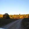
Thanks! Used it to find two NY State Parks about an hour away that are both close to the dark end of the scale. I've visited both before during the daytime, and they have good open areas for observing, so I plan on going to both on a future dark night.
#10
krp
-
-
-
topic starter
- Posts: 461
- Joined: 10 Nov 2010
Vendor. DarkSiteFinder.com
Posted 29 July 2013 - 11:37 AM
Sorry I didn't really optimize the website for mobile devices. I don't have an Ipad to test with either. Maybe someday I'll learn how to build an app though.Would their be any reason why the light pollution map wouldn't show up on an IPad? I can get the map ( underlay) to show up fine but no light pollution map.
Any thoughts? Or is this something you already are aware of? I would love to take a look at your maps!
#11
Daniel Guzas
-
-
- Posts: 1,004
- Joined: 20 Nov 2010
Apollo
Posted 02 August 2013 - 08:29 PM
Ok no worries... Thanks for the reply!
#12
JayinUT
-
-
- Posts: 6,140
- Joined: 19 Sep 2008
I'm not Sleepy
Posted 07 August 2013 - 01:06 PM
Very cool. I like it and it seems to represent the sites I go to pretty accurately save one. Excellent job. Are we going to be able to post our personal observing areas on there if we want?
#13
Tom and Beth
-
-
- Posts: 4,184
- Joined: 08 Jan 2007
Skylab
Posted 07 August 2013 - 04:34 PM
Nice user-friendly site, with a calendar of some useful upcoming events? What's not to like? BOOKMARKED!
Thank you for this effort.
Thank you for this effort.
#14
MDB
-
-
- Posts: 166
- Joined: 06 Jun 2012
Vostok 1
Posted 07 August 2013 - 06:19 PM
Kevin, I've been using DarkSiteFinder.com for about a week and I really like it! Thank you so much for the effort, I hope your goal is achieved too.
Mike
Mike
#15
SUN RA KAT
-
-

- Posts: 128
- Joined: 10 Sep 2011
Vostok 1
Posted 10 August 2013 - 09:42 PM
Have to add my Thank You as well. Dark Skies in Ohio...not enough & far away. Semi dark skies much closer and a heck of a lot better than suburban Dayton skies.
#16
Lee D
-
-
- Posts: 1,527
- Joined: 07 Oct 2009
Surveyor 1
Posted 11 August 2013 - 07:34 PM
Kevin, have you discussed using Dave Lorenz' maps with him?
#17
Lee D
-
-
- Posts: 1,527
- Joined: 07 Oct 2009
Surveyor 1
Posted 11 August 2013 - 08:10 PM
The original "World Atlas" map ranges are ratios between the artificial sky brightness and an average reference natural sky brightness (corresponding approximately to 21.6V mag/arcsec, although the authors go to pains to point out that the natural sky brightness varies considerably based on several factors, and this scale is best seen as a relative scale).
The map level ratios are:
0.00 (black)
0.01-0.11 (gray)
0.11–0.33 (blue)
0.33–1.00 (green)
1–3 (yellow)
3–9 (orange)
9–27 (red)
>27 (white)
I'm wondering, based on the many discussions of sky brightness v. extended object contrast, if this is the most helpful way to segment the light pollution ranges? We need not be limited to the same factor of 3x nor the same number of levels.
In fact, it might be good to intentionally use a number of levels that clearly distinguishes this from the Bortle scale, to prevent further confusion.
#18
Tony Flanders
-
-
- Posts: 23,294
- Joined: 18 May 2006
ISS
Posted 13 August 2013 - 04:52 AM
In fact, it might be good to intentionally use a number of levels that clearly distinguishes this from the Bortle scale, to prevent further confusion.
Attempting to mimic the Bortle scale would simply increase confusion. The color zones based on satellite measurements and the Bortle scale are fundamentally different; there's no way that they can ever correlate with each other.
I deeply regret the original publication of the correlation by the North Virginia Astronomy Club, although their intentions were entirely legitimate. And its propagation through Wikipedia is even more unfortunate. However, the cat's out of the bag now; the harm cannot be undone.
Aside from problems with the underlying data and the fact that it's now more than a decade old, the color zones can at best represent either average skyglow or possibly skyglow under ideal conditions. They don't change from night to night; that's both a good and a bad point.
The Bortle scale represents a subjective evaluation of the sky at one particular time. Despite attempts to smooth it out by using multiple criteria, the assessment is bound to differ from one person to another, and it most certainly varies from one night to another. That's particularly true in the best (lowest) classes. It also inherently factors in transparency as well as artificial skyglow.
SQM measurements are yet another thing. Like the Bortle assessment they vary from night to night -- often by a fair amount. But unlike the Bortle classes they don't take transparency into account. And the SQM measurements are inherently inaccurate at the dark end of the scale due to "contamination" by the Milky Way and zodiacal light.
I use the color zones for two different purposes: to communicate sky conditions between people at different locations and to figure out where to travel to find relatively dark locations. For the former purpose, the current number of levels is probably about right. Any more would give a false sense of precision. For the latter purpose, the more the better.
#19
krp
-
-
-
topic starter
- Posts: 461
- Joined: 10 Nov 2010
Vendor. DarkSiteFinder.com
Posted 13 August 2013 - 01:18 PM
I have attempted to but I got no reply. But since he has the PNG images available for download on his website, I don't think he would have a problem with it. I made sure to give him credit.Kevin, have you discussed using Dave Lorenz' maps with him?
#20
krp
-
-
-
topic starter
- Posts: 461
- Joined: 10 Nov 2010
Vendor. DarkSiteFinder.com
Posted 13 August 2013 - 01:24 PM
I tried to avoid defining exactly what the color zones mean, since I know there has been some confusion with the Bortle scale. The color maps are really just a starting point anyway. They don't take into effect elevation, clouds on the horizon reflecting more light, or distant light domes. The only way to see how dark a site truly is, is to visit there on a good night.
#21
Tony Flanders
-
-
- Posts: 23,294
- Joined: 18 May 2006
ISS
Posted 13 August 2013 - 01:49 PM
The only way to see how dark a site truly is, is to visit there on a good night.
Amen. The maps are tremendously useful, but at best they can only be approximations of reality.
#22
Lee D
-
-
- Posts: 1,527
- Joined: 07 Oct 2009
Surveyor 1
Posted 13 August 2013 - 04:31 PM
Alternate e-mail address for Dave sent via PM.I have attempted to but I got no reply. But since he has the PNG images available for download on his website, I don't think he would have a problem with it. I made sure to give him credit.Kevin, have you discussed using Dave Lorenz' maps with him?
Lee
#23
Lee D
-
-
- Posts: 1,527
- Joined: 07 Oct 2009
Surveyor 1
Posted 13 August 2013 - 04:37 PM
In fact, it might be good to intentionally use a number of levels that clearly distinguishes this from the Bortle scale, to prevent further confusion.
Attempting to mimic the Bortle scale would simply increase confusion.

#24
Lee D
-
-
- Posts: 1,527
- Joined: 07 Oct 2009
Surveyor 1
Posted 13 August 2013 - 08:06 PM
The Wikipedia entry for "Bortle Scale" is now fixed.I deeply regret the original publication of the correlation by the North Virginia Astronomy Club, although their intentions were entirely legitimate. And its propagation through Wikipedia is even more unfortunate. However, the cat's out of the bag now; the harm cannot be undone.

#25
Alein 1630
-
-
- Posts: 129
- Joined: 18 Jan 2013
Vostok 1
Posted 13 August 2013 - 09:49 PM
Would their be any reason why the light pollution map wouldn't show up on an IPad? I can get the map ( underlay) to show up fine but no light pollution map.
Any thoughts? Or is this something you already are aware of? I would love to take a look at your maps!
Same here.
 color doesn't come up??
CNers have asked about a donation box for Cloudy Nights over the years, so here you go. Donation is not required by any means, so please enjoy your stay.

Recent Topics
-
-
-
-
The Moon with my Orion 8" F4 Astrograph 4-16-24
Mikeiss - Apr 19 2024 12:22 PM
Lunar Observing and Imaging
-
-
-
-
-
-